Your vehicles generate a massive amount of data every single day. But is that data actually working for you? Raw numbers about location, speed, and engine status don't automatically lead to better decisions. The key is turning that information into clear, actionable insights you can use immediately.
That’s the core job of a powerful fleet management software with geographic maps. It helps you spot inefficiencies, identify coaching opportunities for drivers, and make smarter operational choices that have a real-world impact on your bottom line.
This article will define geospatial mapping software and discuss information on geospatial data and its origins. We will also highlight the benefits of geospatial mapping, including generating valuable data and decreasing operating costs. Finally, we will outline the best geospatial mapping software on the market today, such as Verizon Connect GeoBase and Azuga’s fleet management software.
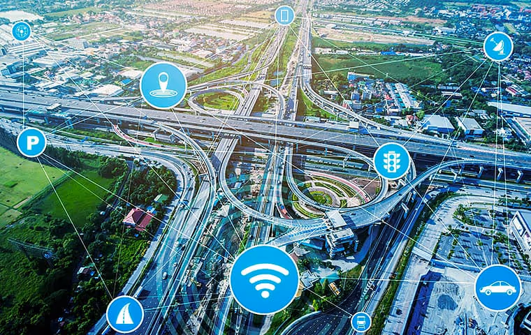
Understanding Geospatial Mapping for Fleets
Geospatial mapping software allows users to add, store, edit, delete, manipulate, visualize, and analyze geospatial data.
What Exactly Is Geospatial Data?
So what is geospatial data? Geospatial data is data that includes a locational or geographic element. Geospatial datasets may include locational data such as city, ZIP code, geographic coordinates, or physical addresses. The location may be dynamic, such as tracking a moving vehicle, or static, like the coordinates of a specific landmark.

Addresses and locations are the simplest forms of geospatial data. However, geospatial data can contain much more information than just a spot on the earth’s surface. Geospatial data sets may also include additional non-spatial information. We call this extra data “attributes.” Geospatial data may have any number of descriptive attributes in addition to standard geographic data. Geospatial data integrates geographic information, attribute information, and time-related information.
Where Does This Location Data Come From?
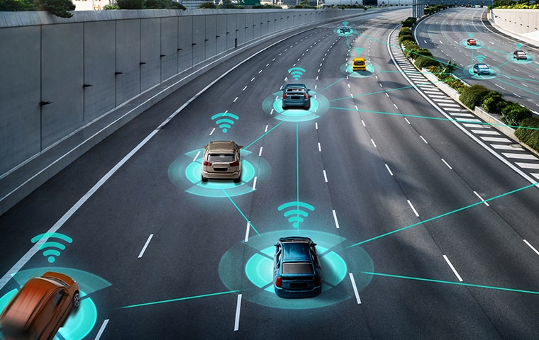
Geospatial data may come from Geographic Information Systems (GIS), Global Positioning Systems (GPS), remote sensing, geotagging, and even satellite imagery. The most complete geospatial data sets combine information gleaned from several of these source types at once.
How Geospatial Mapping Improves Fleet Operations
Fleets, both large and small, can get a ton of benefits from geospatial mapping. Here are a few of the advantages your fleet can gain from the use of geospatial mapping software.
Turn Raw Data into Actionable Insights
Fleet managers can use geospatial mapping data to identify valuable information about their fleet. For example, they can find inefficiencies in a fleet’s operations by determining which vehicles are sitting idle too often and which are being inefficiently routed.
Fleets can monitor drivers on the job with geospatial mapping software. Fleet managers can get precise data on their drivers, such as actual time departed and what course they took. Advanced fleet tracking software using GPS can also detect dangerous driving habits like harsh braking and excessive acceleration. Geospatial mapping software can even help fleet managers catch drivers who use their vehicles for non-work-related purposes.
LEVERAGE ARTIFICIAL INTELLIGENCE
Modern geospatial mapping software uses artificial intelligence to turn vehicle data into smart decisions. By connecting your vehicles to the internet, AI-powered systems analyze complex patterns in routes, driver behavior, and vehicle diagnostics that you might otherwise miss. For instance, an intelligent system can identify the most efficient path for a driver in real-time by considering traffic, weather, and other variables. This technology, like the kind found in an AI dashcam, helps you see the full picture of your operations and find new ways to improve efficiency.
MONITOR AND COACH DRIVER BEHAVIOR
Geospatial data gives you a clear view of what’s happening on the road, creating valuable coaching opportunities. You can track events like hard braking, rapid acceleration, and speeding to identify patterns that might indicate risk. This isn't about catching people making mistakes; it's about proactively improving driver safety. When you know which habits to address, you can provide targeted training and positive reinforcement. Some systems even offer in-cab alerts, giving drivers immediate feedback to help them self-correct and build safer habits over time.
BENCHMARK PERFORMANCE AGAINST INDUSTRY STANDARDS
Wondering how your fleet’s performance measures up? Geospatial mapping software collects key information from your vehicles and transforms it into useful insights. You can set up custom rules and alerts for metrics related to productivity, safety, and vehicle health. This allows you to benchmark your fleet's performance against your own goals and even industry averages. Answering questions like, "Is our idle time higher than last quarter?" or "Are we meeting our on-time delivery targets?" becomes simple, empowering you to set realistic goals and track your progress.
Optimize Routes and Reduce Fuel Waste
By improving safety and optimizing routing, geospatial mapping software can help fleets to decrease costs.
Geospatial mapping software can provide fleet operators with real-time locational data on their vehicles. Managers can use this information to optimize vehicle dispatch and routing to save on time and fuel. Monitoring fleet vehicles’ speed can help reduce speeding and accidents, both of which can be significant expenses. Geospatial mapping can also be combined with traffic and weather data to further enhance drivers’ journeys.
IMPROVE FUEL EFFICIENCY
Fuel is one of the largest operational expenses for any fleet, but geospatial mapping software gives you a powerful way to manage it. With real-time locational data on your vehicles, you can optimize dispatching and routing to save both time and fuel. This isn't just about finding the shortest path; it's about intelligent route optimization that cuts down on unnecessary mileage and idle time. You can also monitor vehicle speed to reduce speeding, a habit that wastes fuel and increases accident risk. By combining geospatial maps with live traffic and weather data, your drivers can avoid delays and keep their journeys efficient, making every gallon count.
Create virtual boundaries with geofencing
Think of geofencing as drawing an invisible fence around a real-world location on a map. This feature uses GPS to create a virtual boundary around a specific area, like a job site, your main yard, or a customer's location. When a vehicle equipped with a tracker enters or leaves this predefined zone, the system can automatically trigger an alert.
This capability gives you incredible operational awareness. You can automatically log when a crew arrives on-site and when they depart, simplifying time tracking and job verification. It also helps you ensure drivers are sticking to their assigned territories and not making unauthorized stops, which keeps your entire operation running smoothly.
Enhance vehicle and asset security
Geofencing is also a powerful tool for protecting your fleet's vehicles and equipment. You can set up geofences around your company yard or storage locations to create a virtual security perimeter. If a vehicle or a valuable piece of equipment is moved outside of this area during off-hours, you’ll receive an immediate alert.
This instant notification allows you to act quickly in the event of a potential theft, increasing the chances of recovery. By using a robust asset management system, you can extend this protection beyond your trucks and vans to include trailers, generators, and other high-value equipment. It’s peace of mind, knowing your assets are monitored even when no one is physically watching them.
Ensure regulatory compliance
Geospatial technology is fundamental to meeting many industry regulations. For fleets subject to the Electronic Logging Device (ELD) mandate, GPS data is the engine that powers automated Hours of Service (HOS) tracking. This eliminates the need for manual paper logs, which are prone to errors and can be time-consuming for drivers.
Modern compliance management solutions use location data to automatically record driving time, on-duty hours, and rest periods with precision. This not only simplifies the driver's daily routine but also ensures your records are accurate and ready for any roadside inspection. Staying compliant becomes a seamless part of your daily operations, helping you avoid violations and maintain a strong safety record.
Choosing the Right Fleet Management Platform
With so many options available, selecting the right fleet management platform can feel overwhelming. The key is to look past the flashy sales pitches and focus on the features, flexibility, and support that will actually make a difference in your daily operations. A great platform should feel like a true partner, providing the tools you need to run a smarter, safer, and more efficient fleet. It’s about finding a solution that empowers you to get more done with less stress.
Key Features to Look For
The foundation of any good fleet management system is its feature set. You need a solution that not only tracks vehicle locations but also provides deep, actionable insights. Look for a platform that addresses the real-world challenges your fleet faces, from managing new vehicle technologies to ensuring your drivers and assets are protected on the road. The best features turn raw data into real-world results that you can see in your bottom line.
ELECTRIC VEHICLE (EV) TRACKING CAPABILITIES
As more fleets incorporate electric vehicles, specialized tracking becomes essential. Standard GPS is not enough. A modern platform should offer EV-specific data, such as real-time battery levels, charging status, and range anxiety alerts. This information allows you to optimize routes based on available charging stations and ensure your EVs are always ready to go, making the transition to electric smooth and predictable for your entire team.
VEHICLE HEALTH AND MAINTENANCE MONITORING
Geospatial data is about more than just dots on a map. A powerful platform uses telematics to monitor vehicle health, flagging diagnostic trouble codes before they lead to major breakdowns. By automating scheduled maintenance, you can move from a reactive to a proactive strategy, reducing downtime and extending the life of your vehicles. This keeps your fleet on the road and out of the shop, where it belongs.
INTEGRATION WITH DASHCAMS AND OTHER TOOLS
Your telematics data becomes even more powerful when combined with other tools. Integrating an AI dashcam provides visual context for events like harsh braking or collisions, which is invaluable for coaching drivers and protecting your business from false claims. The right platform should serve as a central hub, connecting all your operational tools for a seamless workflow and a complete picture of your fleet's performance.
Software and Hardware Flexibility
Your business is unique, and your fleet management solution should be too. A one-size-fits-all approach rarely works. Seek out a provider that offers the flexibility to adapt the system to your specific needs, whether it’s through cloud-based access, customization options, or a variety of hardware that fits every vehicle and asset in your operation. This ensures the solution works for you, not the other way around.
CLOUD-BASED PLATFORM ACCESS
Modern fleet management happens everywhere, not just behind a desk. A cloud-based platform means you don’t have to install cumbersome software on your computers. You can securely access your fleet data from any web browser. Plus, a robust fleet mobile app gives you the freedom to manage operations from the field, ensuring you’re always connected to your team and your vehicles.
CUSTOMIZATION THROUGH A PARTNER MARKETPLACE
No single platform can do everything perfectly. That’s why a strong partner marketplace is a sign of a mature and flexible solution. It allows you to add specialized applications and tools that integrate directly with your telematics data. This way, you can build a customized system that solves your specific challenges without paying for features you don’t need, creating a truly tailored solution.
MULTIPLE HARDWARE OPTIONS
Your fleet likely consists of more than just one type of vehicle. You may have heavy-duty trucks, light-duty vans, and valuable equipment that all need to be tracked. A flexible provider will offer a range of hardware, from simple plug-and-play OBD-II devices to more robust, hardwired trackers and battery-powered units for asset management. This ensures every part of your operation is visible.
Evaluating Provider Support and Credibility
The technology itself is only half the equation. The company behind the software is just as important. You need a provider you can trust to be there when you need them, with a proven track record of helping fleets like yours succeed. Look for a partner who is invested in your success for the long haul and acts as a steady hand on the wheel for your operations.
AVAILABLE SUPPORT AND SERVICE
When a vehicle is down or you have a question, you can’t afford to wait for an answer. Look for a provider that offers accessible, expert support. Whether it’s through phone, email, or a dedicated account manager, having a reliable support system ensures you can resolve issues quickly and get the most value from your investment. Great support is a hallmark of a great partner.
FLEXIBLE SUBSCRIPTION MODELS
Your fleet’s needs will change over time, so your telematics plan should be able to grow with you. A good provider offers flexible subscription models that allow you to scale up or down as needed. This ensures you have a solution that fits your operational requirements and budget without locking you into a rigid, long-term contract that no longer serves your business goals.
INDUSTRY RECOGNITION AND EXPERIENCE
Finally, consider the provider’s reputation in the industry. A company with years of experience and recognition from industry analysts has a proven history of delivering reliable solutions. Customer testimonials and case studies can also provide real-world insight into how the provider supports its clients and helps them achieve their goals, reinforcing that you’re making a confident choice.
Top Fleet Management Software with Geographic Maps
Of all the geospatial mapping software available to fleets today, two options stand out amongst the crowd as the best: Verizon Connect’s GeoBase and Azuga’s fleet management software.
A Look at Verizon Fleet Management Software
Verizon Connect’s GeoBase is a robust geospatial mapping software that can handle demanding environments and challenging business needs.” The software includes route optimization capabilities and allows for integrating additional data such as traffic volume and truck restrictions.
GeoBase’s mapping engine uses the GeoBase File System to generate detailed maps. Every aspect of map visualization is customizable. Users can layer custom GIS data over maps and even overlay satellite images.
A useful feature of GeoBase is reverse geocoding and rule processing. Verizon Connect claims that “high-performance reverse geocoding is a cornerstone of GeoBase’s design.” The software enables large volume latitude and longitude processing.
GeoBase also features address lookup and a map display editor. The address lookup is scalable with a geocoding engine that can handle a high-volume of requests. It can identify locations from text provided by the user. GeoBase lets users create and view hybrid maps that are composed of both aerial and satellite imagery. Additionally, the software contains custom data layers to meet your unique business needs.
The software also allows managers to choose what different groups of users to access specific types of data. Managers can even utilize tags to locate the right person or equipment closest to the job. GeoBase also includes flexible geofencing to alert you when a fleet vehicle leaves its designated location.
How Azuga Puts Geographic Maps to Work
Azuga’s fleet management software utilizes GPS data to generate geospatial maps. Installation is easy: all you need to do is plug the Azuga GPS Tracker into your vehicles’ OBDII ports. The device will then generate diagnostic data to be sent to your Azuga dashboard, accessed through a computer or mobile device. There is no need for expensive installation services, and vehicles experience virtually zero downtime.
With Azuga’s fleet management software, managers can see each vehicle’s journey and track road events on a point-by-point basis. The software also features geofencing capabilities for both vehicles and large equipment. Managers can receive alerts when vehicles exit or enter predetermined zones and get data on how long vehicles spend in the geofenced area.
Azuga offers software that can run in your main office or through their free fleet tracking app on your preferred device. You can see the full dashboard while on the go, giving you access to data relating to safety, maintenance, dispatch, and more. There’s even a driver rewards program to help you create a culture of safety within your fleet.
If your fleet hasn’t made the jump to a fully-featured fleet management software package yet, it’s time to look into your options. Contact Azuga today to learn more about how we can help.
Frequently Asked Questions
What's the difference between basic GPS tracking and geospatial mapping software? Basic GPS tracking simply shows you a vehicle's location on a map. Geospatial mapping software does much more by turning that location data into useful information. It combines location with other details like driver behavior, route history, and vehicle health to give you a complete picture. This helps you spot inefficiencies and make smarter decisions instead of just watching dots move on a screen.
How does this software actually improve driver safety? This technology helps you move from reacting to incidents to proactively coaching safer habits. The system identifies risky behaviors like harsh braking, speeding, or rapid acceleration, giving you concrete data for targeted training. It’s about understanding patterns and providing support where it's needed most, creating a culture of safety rather than just monitoring drivers.
Can I use this system for different types of vehicles and equipment? Yes, a flexible platform is designed to handle a mixed fleet. You can use different types of hardware for different assets. For example, you can use simple plug-in devices for your light-duty trucks and more durable, battery-powered trackers for trailers or heavy construction equipment. This allows you to see your entire operation on one unified platform.
How does geofencing work in a practical sense? Geofencing allows you to draw a virtual boundary around any real-world area on a map, such as a job site, a restricted zone, or your company yard. The system then automatically alerts you when a vehicle or asset enters or leaves that predefined space. This is useful for verifying service times, ensuring drivers stick to their routes, and enhancing the security of your equipment after hours.
What's involved in getting a system like this set up for my fleet? Getting started is often quite simple. Many modern systems use plug-and-play devices that you can install yourself in minutes by connecting them to the vehicle's OBDII port. This approach avoids complicated installations and lengthy vehicle downtime. Once the device is connected, it starts sending data to your dashboard almost immediately.
Key Takeaways
- Go beyond location tracking: Use geospatial mapping to turn raw vehicle data into clear business intelligence, helping you spot operational inefficiencies, create coaching opportunities for drivers, and make smarter routing decisions.
- Put key features to work: Use specific tools for practical benefits. Geofencing helps secure assets and automate time tracking, while AI-powered analytics find the most efficient routes and driver monitoring builds a proactive safety culture.
- Choose a partner, not just a platform: The right solution is backed by a supportive provider, so look for a company that offers flexible hardware, a cloud-based system with mobile access, and a proven record of reliable support to meet your fleet's unique needs.